Translate this page:
| Pincode | 424203 |
| Name | Chinchpure B.O |
| District | Jalgaon |
| State | Maharashtra |
| Status | Branch Office(Delivery) |
| Head Office | Chalisgaon H.O |
| Sub Office | Pimpalgaon S.O |
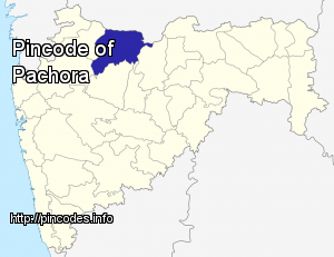
| Location | Pachora Taluk of Jalgaon District |
| Telephone No | Not Available |
| SPCC | JALGAON-425001 |
| Department Info | Jalgaon Division Aurangabad Region Maharashtra Circle |
| Address | Maharashtra 424203, India |
| Services | |
| Indian Postal Code System Consists of Six digits. The first to digits represent the state, the second two digits represent the district and the Third two digits represents the Post Office.In this case the first two digits 42 represents the state Maharashtra, the second two digits 42 represent the district Jalgaon, and finally 03 represents the Post Office Chinchpure B.O. Thus the Zip Code of Chinchpure B.O, Jalgaon, maharashtra is 424203 | |
| Pincode | 424203 |
| Name | Pimpalgaon S.O |
| District | Jalgaon |
| State | Maharashtra |
| Status | Sub Office(Delivery) |
| Head Office | Chalisgaon H.O |
| Sub Office | |
| Location | Pachora Taluk of Jalgaon District |
| Telephone No | |
| SPCC | JALGAON-425001 |
| Department Info | Jalgaon Division Aurangabad Region Maharashtra Circle |
| Address | Pimpalgaon Hareshwar, Maharashtra 424203, India |
| Services | EMS (International Speed Post) E-Payment Epost Inland Speed Post Instant Money Order International Mails Money Order Postal Banking Service Postal Life Insurance Postal Orders Postal Stationary Registered Posts |
| Indian Postal Code System Consists of Six digits. The first to digits represent the state, the second two digits represent the district and the Third two digits represents the Post Office.In this case the first two digits 42 represents the state Maharashtra, the second two digits 42 represent the district Jalgaon, and finally 03 represents the Post Office Pimpalgaon S.O. Thus the Zip Code of Pimpalgaon S.O, Jalgaon, maharashtra is 424203 | |


Pachora is a city and a municipal council in Jalgaon district in the Indian state of Maharashtra and situated on the bank of the Hivra River.
Pachora Junction (पाचोरा जंकà¥à¤¶à¤¨) is located at 20.67°N 75.35°E / 20.67; 75.35. It has an average elevation of 261 metres (856 feet). Population of Pachora is 255000. Pachora's zipcode is 424201 and Telephone area code is 02596.
Pachora Municipal Council has established on 1 April 1947. Now there are 25 wards are mapped for Pachora Municipal Council with 25 Members of Nagarpalika. Pachora also has a Vidhan-Sabha Constituency from 1952. Pachora has a large rural infrastructure with 95 Grampanchayat which is largest in the any other tehshiMore Info